A few weeks ago we mentioned we had taken old maps of the village from the National Library of Scotland side by side map archive. We perhaps understated how marvellous their web site is. This screen shot of Milton should give you an idea (although sadly shrunk to fit the space available – the maps are rather bigger on the site itself).
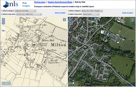
You can scroll around the maps by dragging either map and the other follows and also zoom in and out. Each map window can show data taken from OS maps from 1888 through to 1961 and aerial photography from various sources. Do visit the site and have a look. We think you’ll be fascinated.

